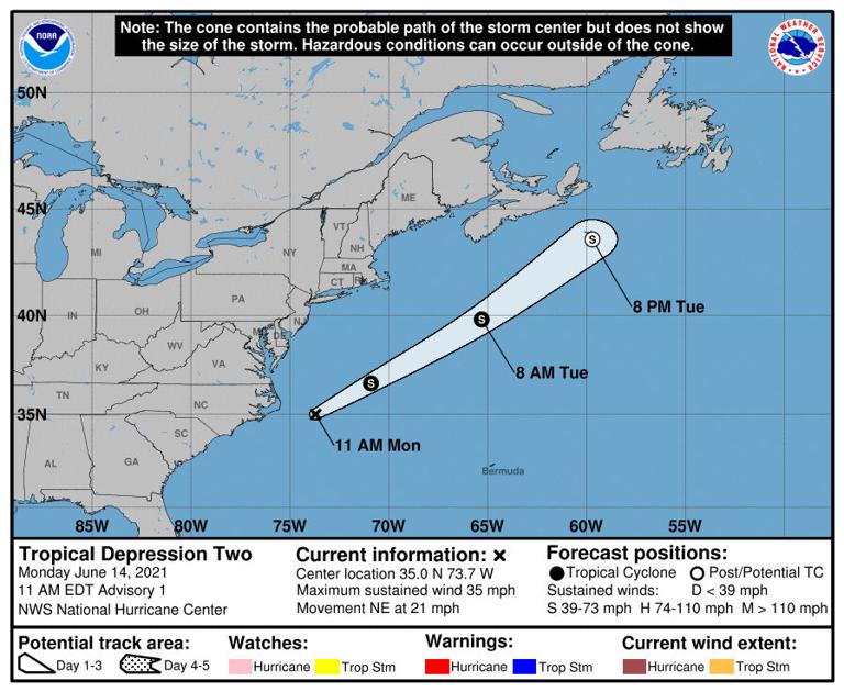
NEWPORT — A tropical depression has formed right off the North Carolina coast, but is moving away from the U.S. as it grows stronger.
The National Hurricane Center issued an advisory at 11 a.m. Monday for a tropical depression which formed about 105 miles east of Cape Hatteras National Seashore. The depression has maximum sustained winds of 35 mph and, as of 11 a.m. Monday, is moving northeast at 21 mph. Its minimum central barometric pressure is 29.71 inches.
Forecasters with the National Weather Service’s Newport office indicated in an announcement Monday there isn’t much threat to Carteret County or the rest of the state’s coast.
“Other than a moderate threat of rip currents that’s in effect through (Monday) afternoon north Cape Hatteras, no impacts to coastal eastern North Carolina will be felt with this system as it moves quickly away from the offshore coastal waters,” NWS meteorologists said.
The NHC forecasts the depression will strengthen to a tropical storm Monday night as it continues moving northeast and may continue to strengthen Tuesday, then start to weaken by Tuesday night and dissipate Wednesday.
As the weather system moves away from the coast, Carteret County may see some rain later in the week. According to the NWS Newport office, Monday night will be mostly cloudy, with a 50% chance of thunderstorms Tuesday, decreasing to 30% Tuesday night.
Wednesday’s forecast includes a 40% chance of thunderstorms, dropping to 30% Wednesday night, with clear, sunny conditions for the remainder of the week.
Contact Mike Shutak at 252-723-7353, email mike@thenewstimes.com; or follow on Twitter at @mikesccnt.