
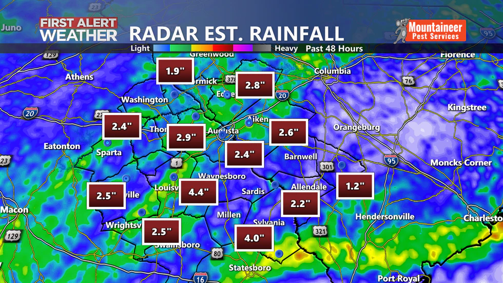
AUGUSTA, Ga. (WRDW/WAGT) – Tropical Depression Claudette has moved east of the CSRA taking the rain with it.
We did pick up a good amount of rainfall over the last two days with some communities reaching 4+ inches.
As we continue, temperatures will hold in the low to mid 70s across the CSRA with winds falling between 5 and 10 mph. Becoming breezy again this afternoon with warmer afternoon temps near 90 degrees.
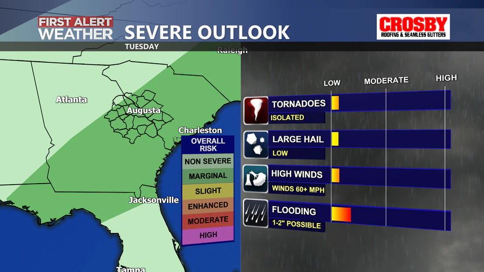
What’s left of the tropical system will continue to move to the east/northeast this morning with a cold front following in its wake bringing the chance for additional showers and storms this afternoon and Tuesday. Scattered storms will linger in the area Wednesday through Saturday, but not everyone will see the rain. There will be the potential for isolated severe storms Tuesday afternoon as the front pushes through the region,
so be sure to keep it here for the latest updates.
Copyright 2021 WRDW/WAGT. All rights reserved.