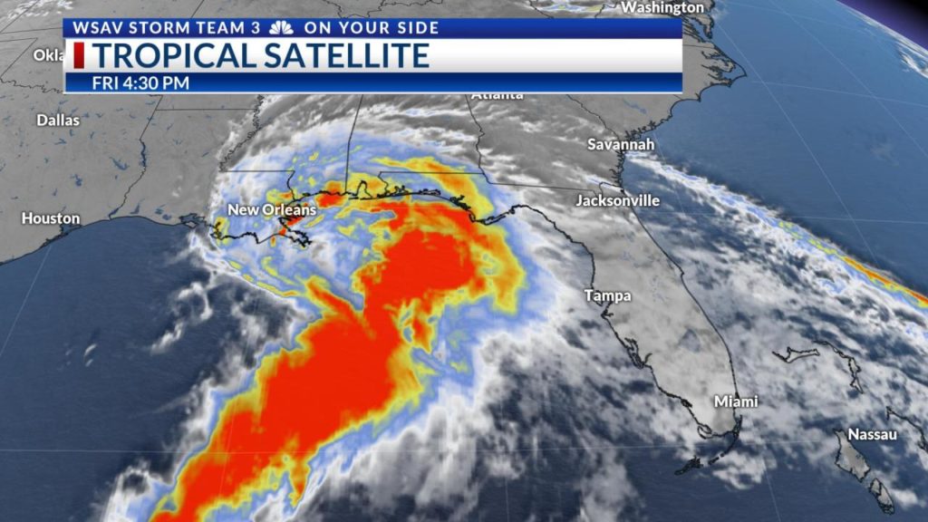
SAVANNAH, Ga. (WSAV) — The system in the Gulf designated as potential tropical cyclone Three has become a little stronger though the day Friday. It is likely that this system will further organize into a tropical depression or tropical storm later tonight.
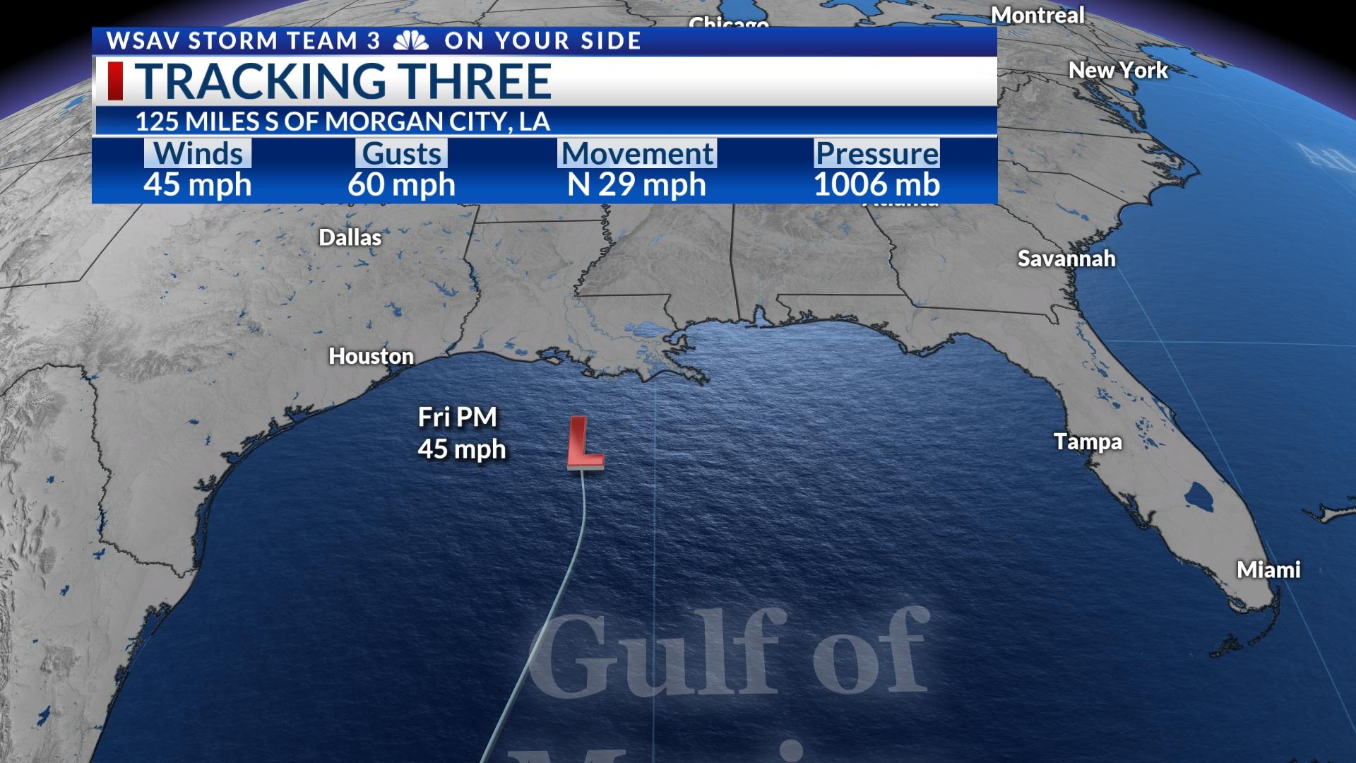
As of the 5 PM advisory from the National Hurricane Center, PTC Three has 45 mph sustained wind with wind gusts as high as 60 mph. Tropical storm force wind extend 205 miles from the broad center of circulation.
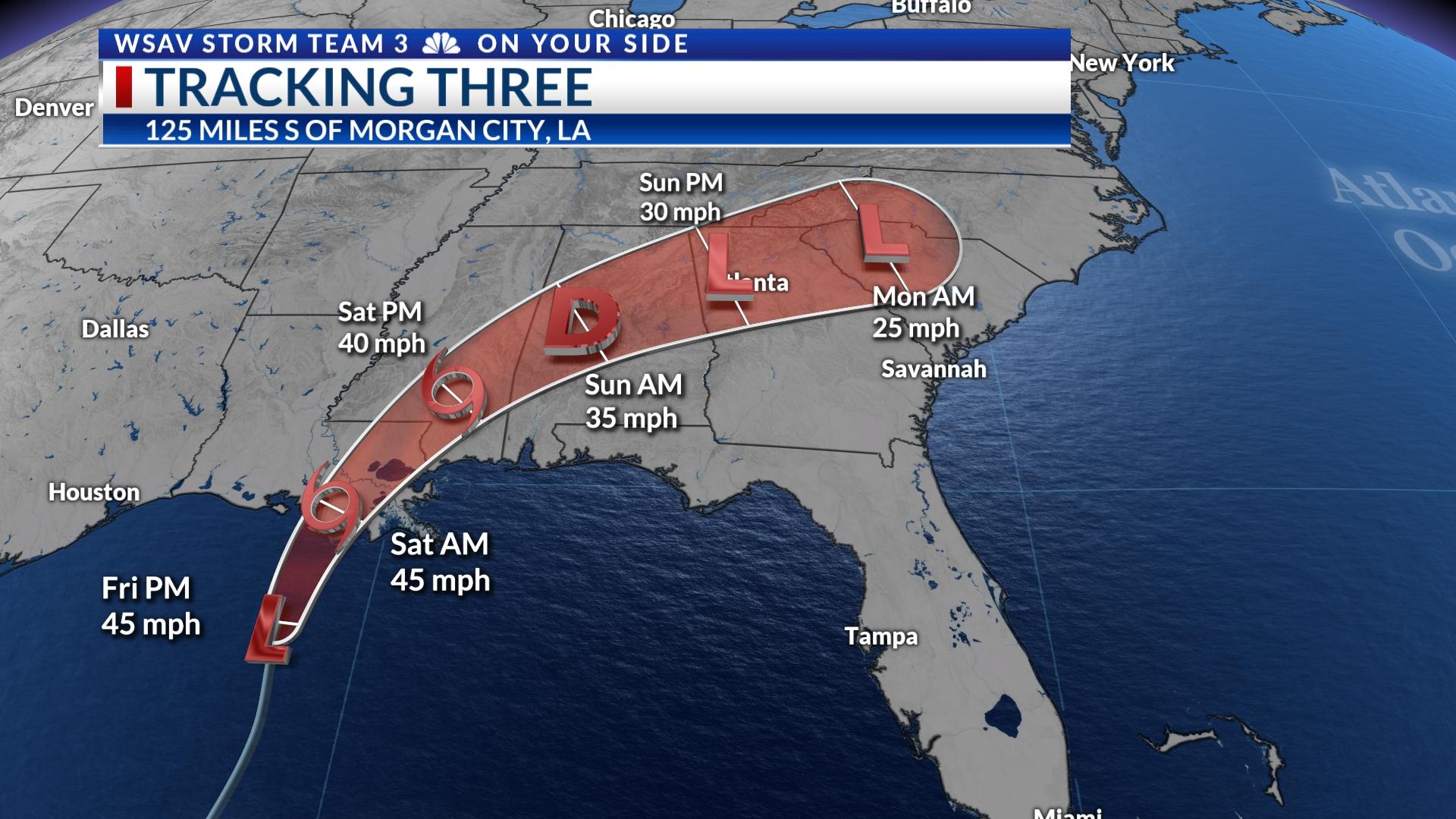
Movement is to the north at 29 mph, which is fast for a system like this and could help limit how strong it may become. PTC Three is located 125 miles to the south of Morgan City, Louisiana.
Landfall along the Louisiana coast is expected to occur early Saturday morning.
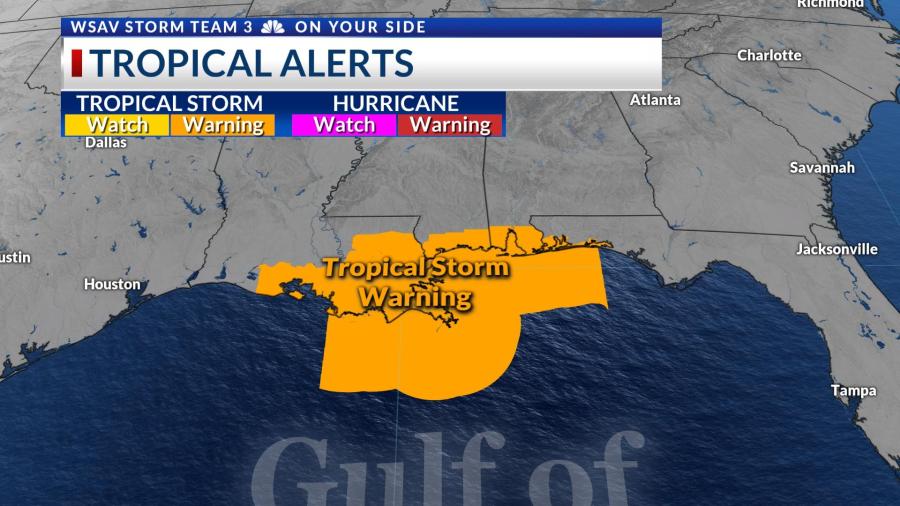
A tropical storm warning is in place for coastal zones stretching from Central Louisiana eastward to include portions of the Florida Panhandle.
This system currently lacks full topical characteristics, however it is expected to become better organized over the next several hours as it moves toward the Louisiana coast. As it becomes better organized, the wind may become a little stronger.
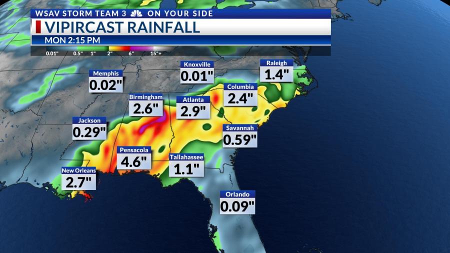
Potential impacts for the Gulf Coast from this system are primarily strong wind and very heavy rain. Widespread areas are expected to be between 4 to 8 inches. Some localized areas may be able to receive closer to a foot of rain which will lead to flash flooding concern. The highest rain amounts will be closer to the path of the center of circulation and closer to the Gulf Coast.
Direct impacts for Georgia and South Carolina will be minimal, but will be felt on Sunday. We do expect breezy conditions at times and periods of potentially heavy rain and thunderstorms. At this time, there is a low chance that a few of the storms associated with this will become strong to severe.