Tropical disturbance 92L in the southern Gulf of Mexico was growing more organized and spreading heavy rains over southern Mexico and Central America on Thursday, and it has the potential to develop into a tropical or subtropical depression by Friday. Regardless of development, 92L will bring heavy rains and dangerous flash flooding to the central U.S. Gulf Coast beginning on Friday, and it could become Tropical Storm Claudette before making a U.S. landfall Friday or Saturday.
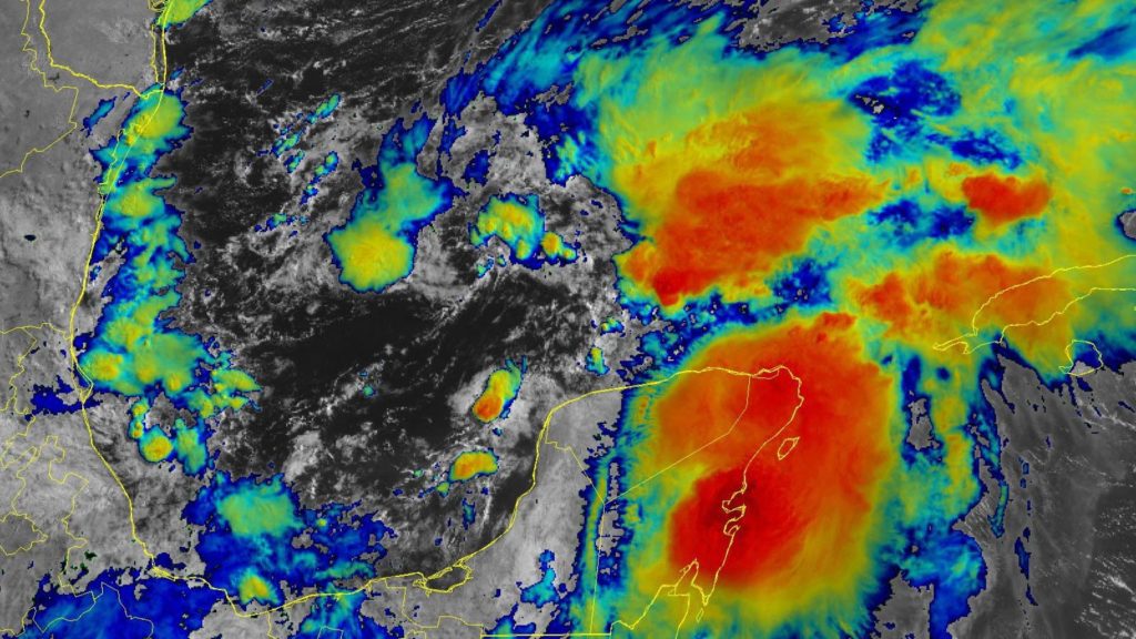
On Thursday afternoon, 92L was nearly stationary over the southern Gulf of Mexico. The system had modestly favorable conditions for development, with warm waters of 28-28.5 degrees Celsius (82-83°F) and a very moist atmosphere with a relative humidity at mid-levels of 75%. However, high wind shear of 20-25 knots was inhibiting development. Satellite loops showed 92L with a broad circulation, but poorly organized. Heavy thunderstorms were on the increase, though, with several curved low-level bands developing. An upper-level trough of low pressure over the western Gulf was acting to increase 92L’s heavy thunderstorms, and was also giving the developing storm a more subtropical than tropical appearance.

Forecast for 92L
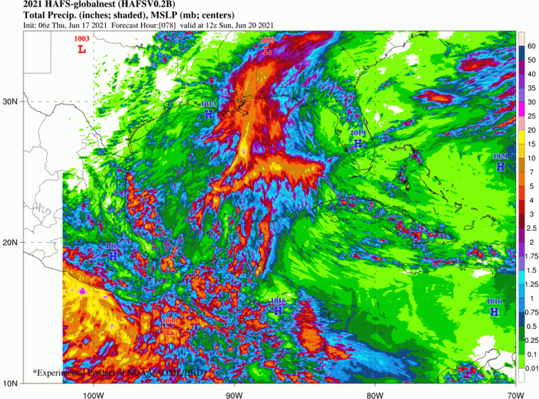
Steering currents are expected to push 92L slowly northwards at about 5 mph beginning Thursday night. The system will then accelerate to a forward speed of 10-15 mph on Friday, which should result in a landfall over the central or northwest U.S. Gulf Coast Friday night or Saturday morning. The landfall location of 92L could range anywhere from the Upper Texas coast to the Alabama/Florida border, according to the latest model predictions. However, the exact landfall location of 92L’s center is relatively unimportant, as heavy rain will be the storm’s main threat, and a wide swath of heavy rain will affect the central Gulf Coast regardless of 92L’s exact track. Because of dry air over the western Gulf as a result of the presence of an upper-level trough, the heaviest rains and strongest winds of 92L will lie almost entirely to the east of the center.

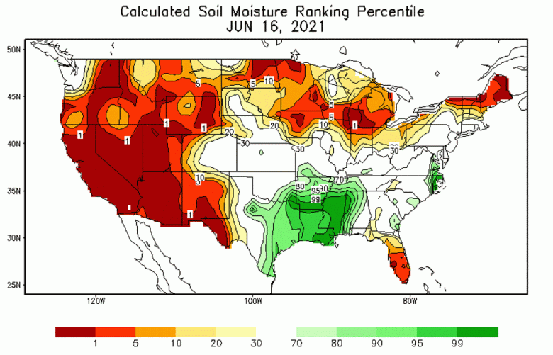
Satellite measurements of total precipitable water (the amount of rain that would fall in a column of air if all the liquid, solid, and condensed water vapor fell as rain) showed 92L embedded in a very moist tropical airmass. This moisture will begin moving inland over the central U.S. Gulf Coast on Friday. Even if 92L does not develop into a tropical cyclone, its high level of moisture will likely will lead to rainfall amounts of 5-10 inches along the coast June 18 through June 20, causing damaging flash flooding. Already, soil moisture as of Wednesday, June 16, ranked in the top 1-5% of climatology for the date across the region likely to see 92L’s heaviest rains (Figure 2).

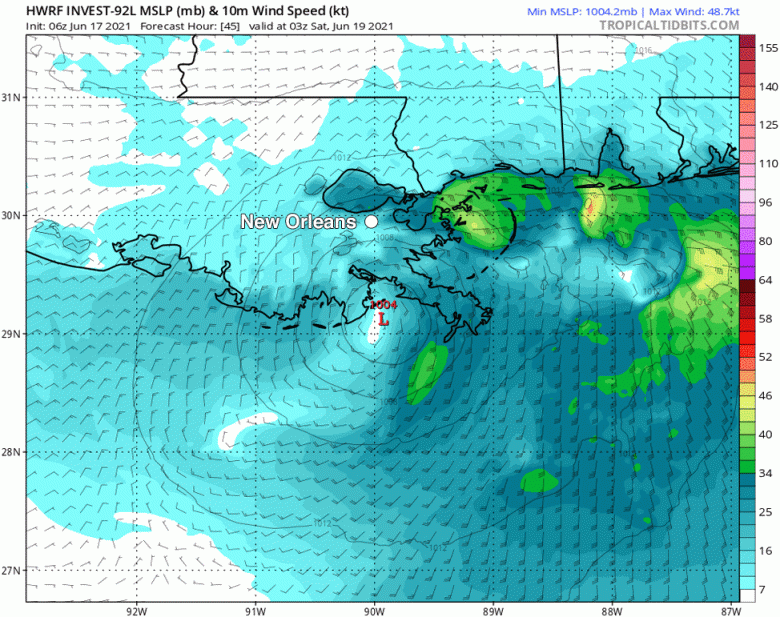
As 92L moves northwards over the Gulf, it will encounter cooler waters, increased wind shear, and drier air. Given 92L’s current disorganized state, these conditions suggest that the strongest 92L will get before landfall is a 60-mph tropical storm. A landfall of weaker intensity is more likely.
There is strong model support for development of 92L into a tropical depression by Friday, when it will be over the northern Gulf of Mexico. In an 8 a.m. EDT Thursday tropical weather outlook, the National Hurricane Center gave 92L two-day and five-day odds of development of 90%. An Air Force hurricane hunter aircraft is scheduled to investigate 92L on Thursday afternoon.
Bob Henson contributed to this post.
Website visitors can comment on “Eye on the Storm” posts. Please read our Comments Policy prior to posting. Comments are generally open for 30 days from date posted. Sign up to receive email announcements of new postings here. Twitter: @DrJeffMasters and @bhensonweather