NEW ORLEANS (WVUE) – It will mainly stay hot and mostly dry into Thursday. The heat index will peak at around 105 in the afternoon.
The big question is the Gulf of Mexico. At this time it is a broad area of low pressure with no trackable center. Until a defined center forms, computer modeling is not much use as far as specific impacts.
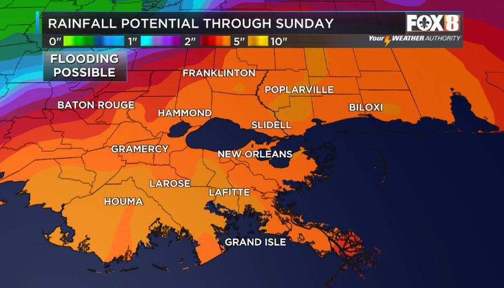
At this time, Southeast Louisiana and the Gulf Coast need to be prepared for a tropical system making landfall along the coast by Friday night or Saturday morning. Since June storms tend to be broad and rather sloppy, the impacts like high tides and flooding rains could extend well away from our area as well.
Whatever does develop will move out of the region by the beginning of next week on Monday.
More: A look back at memorable June tropical systems
Track the tropics in real-time with VIPR radar in the Weather Authority Hurricane Center
Stay with our hurricane section for the latest.
See a spelling or grammar error in our story? Click Here to report it. Please include the headline.
Copyright 2021 WVUE. All rights reserved.