
(Update: Tropical Depression 2 has officially formed about 105 ESE of Hatteras. It is expected to stay offshore, but it is forecast to be a tropical storm briefly. Should dissipate in a couple of days)
When I got in this morning things were pretty quiet, but the forecast wasn’t super Rosy. We are looking at some isolated showers and storms this afternoon, and there is a moderate threat for rip currents. No big deal. However, the tropics had changed dramatically within a 5 hour period. Upon starting the shows the National Hurricane Center said that there was a non-tropical low about 90 miles off the coast of Hatteras, and it had a low chance of tropical formation. By 8am that risk had been upgraded to a high chance.
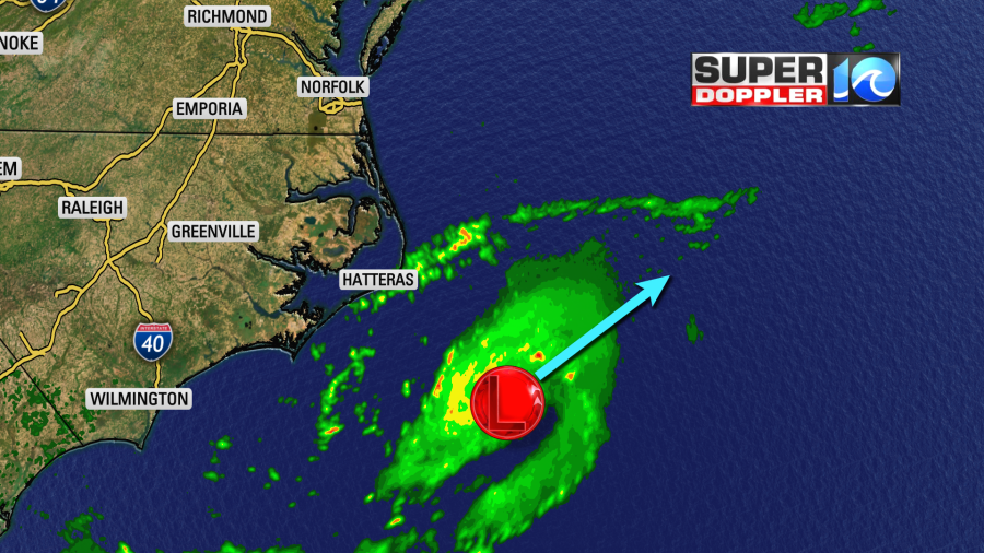
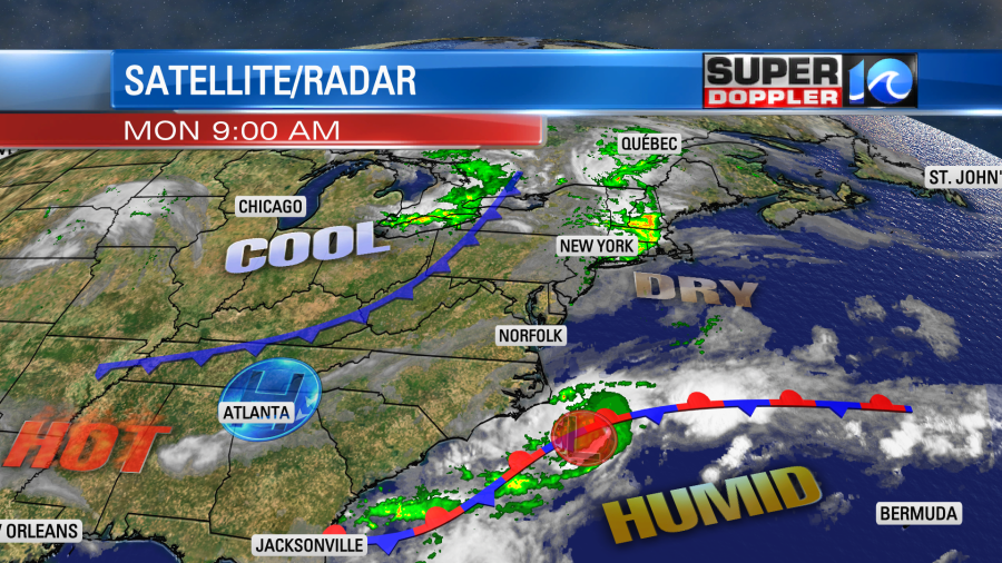
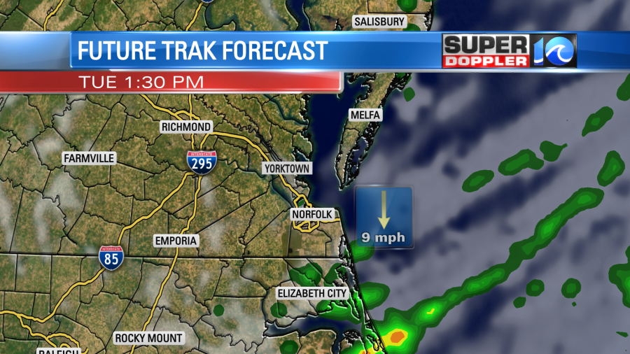
This low is along a stationary front, but rain started increasing and spinning around the low. The models don’t really do much with this system. The GFS and Euro both send it off to the northeast, but they keep it fairly weak.
If it does move to the northeast then it will cross over some warm water, but it will also run into a high amount of wind shear. So I think the only impact here locally would be an increased threat for rip currents, and possibly some nice waves for surfers.
There is another weak disturbance down across the southwestern Bay of Campeche. This has a low chance of formation over the next couple of days.
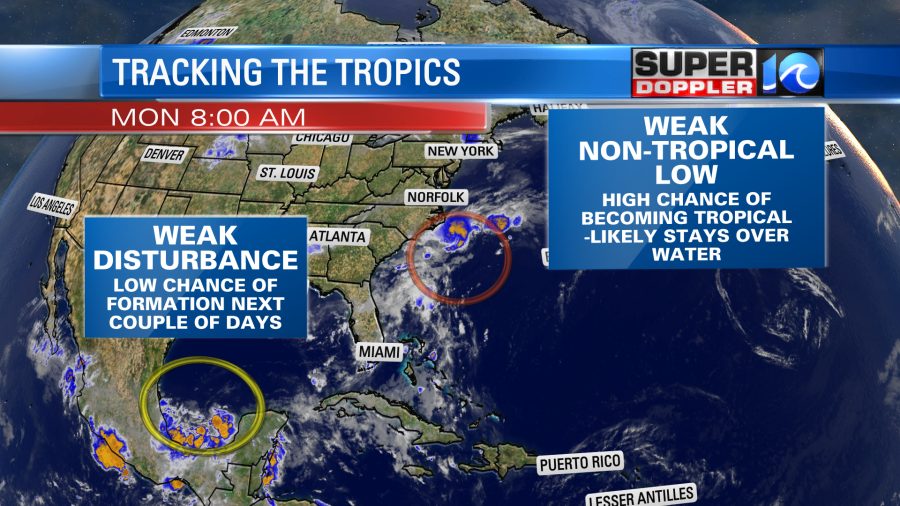
However, the models actually do strengthen this feature over the next couple of days, and they send it northward towards the Gulf Coast in a few days. So we’ll see how these features behave.
Other than that the local weather is pretty quiet. We have the offshore low along the stationary front to our southeast. Also, there is a cool front to our northwest.
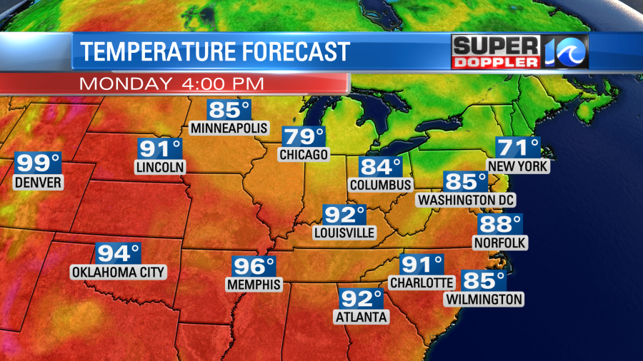
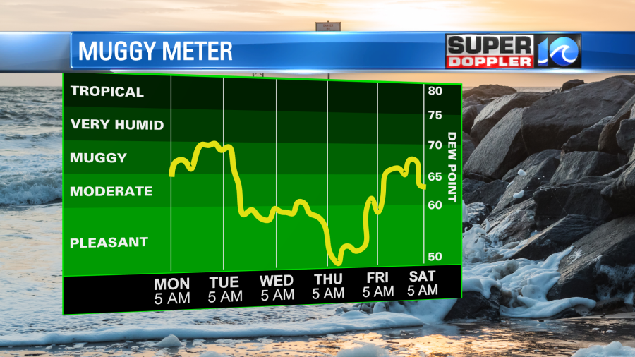
The humidity isn’t as bad as it was last week. Let’s say it’s moderate with dew points in the 60s. We’ll be partly cloudy today with some isolated showers and/or storms popping up this afternoon. High temps will warm up to the upper 80s with a couple of 90s inland. Temps will be a little above average in our region, but it won’t be nearly as hot as some of the western and central states.
We could see a few more scattered showers by the early evening.
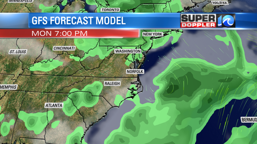
Tomorrow the cool front will steadily slide through the region. We’ll have a mix of sun and clouds with a few showers and storms from the late morning until the early afternoon. As the front drops down into North Carolina during the mid afternoon they will have a little higher chance for rain and storms there.
High temps will be in the mid 80s with upper 80s to the south and a few temps near 80 north. Winds will turn out of the north.
We’ll cool down on Wednesday with highs in the upper 70s to near 80. There may be a lingering shower, but overall we’ll start drying out. Then we’ll be dry and warmer to end the week. Humidity levels should be nice by then.
Meteorologist: Jeremy Wheeler