We will likely see a tropical depression develop in the Gulf that will move east of our area limiting its impacts. The heat will continue until a cold front arrives early next week with showers and thunderstorms.
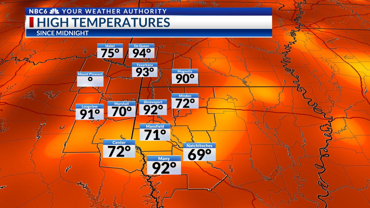
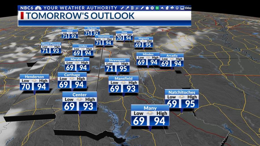
Thursday was another partly cloudy and hot day around the ArkLaTex. Temperatures began in the low to middle 70s and have returned to the low to middle 90s this afternoon. Don’t expect much change Friday. We will likely end the work week with slightly cooler temperatures in the morning. Lows Friday morning will dip into the upper 60s to lower 70s. Daytime highs Friday afternoon will return to the middle 90s.
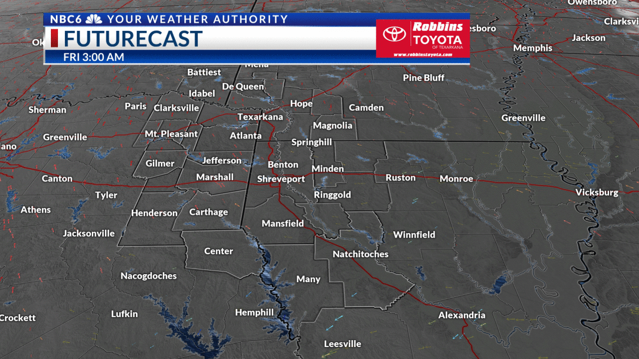
Futurecast shows that the vast majority of the area will stay dry Friday. Look for a mostly clear sky tonight. We will once again see plenty of sunshine Friday with a few more clouds mixing in with the sunshine over the southern edge of the region. Most of the area will once again stay dry Friday. However, a stray shower cannot be ruled out late in the day over the south part of the area.
Potential Tropical Impacts
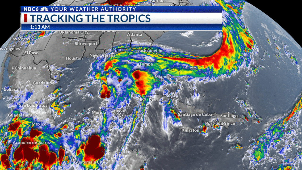
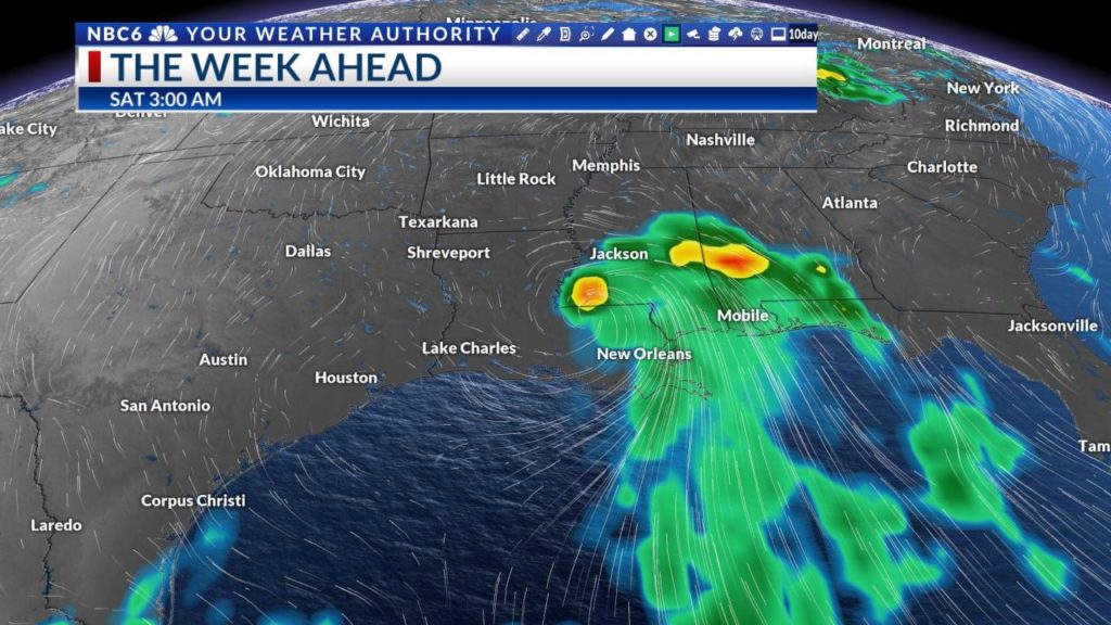
Our weather Friday night and Saturday will greatly depend on where a likely tropical depression tracks through the Gulf of Mexico. Global models still indicate that we will see the system make landfall somewhere along the southern Louisiana coast this weekend. The storm will then track northeast and move well east of our area. Tropical models are much further west and much slower with the movement of the storm. Since we have seen more consistency recently from the global models from model to model and from model run to model run, I would expect the faster and more easterly track. This would limit the impacts that the ArkLaTex would experience. Consequently, rain chances should remain rather low this weekend. Expect highs to be in the low to middle 90s and lows to be in the low to middle 70s.

Our attention will then turn to a cold front that will move through the area Monday night. Showers and thunderstorms will be likely along the front with some locally heavy rain. The severe risk is looking rather low but a severe storm or two cannot be ruled out. We will see a brief break from the heat for the middle of next week. Highs Tuesday and Wednesday will ease into the mid to upper 80s. Overnight lows will dip into the 60s and low 70s. Next week will end with a very low chance of rain and the return of the heat. Expect highs late next week to be in the low to middle 90s. Overnight lows will be in the low to middle 70s.
As mentioned above, there is still some uncertainty as to where the Gulf disturbance will track. If it does take a much more westerly course, then our area will likely see much more rain this weekend. Stay Tuned!
–Todd Warren